We'll find the best
vineyard locations for you
Specify an area and we'll scan it for vineyard potential. You'll receive an interactive map with the best locations.
BETA until end of 2026 - all plans free!
Order free analysisHow does it work?
Provide location
Point to a central location or area you're interested in
Choose a plan
From 25 to 400 points within a 5-20 km radius
We scan the area
We analyze climate, soil, and topography of each point
Get your report
PDF + interactive map with location rankings
Choose a plan
BETA until end of 2026 - all plans free!
Basic
BETA until end of 2026
- ✓ 25 points for analysis
- ✓ 5 km radius
- ✓ PDF Report
- ✓ Interactive map
Standard
BETA until end of 2026
- ✓ 100 points for analysis
- ✓ 10 km radius
- ✓ PDF Report
- ✓ Interactive map
- ✓ Variety recommendations
Enterprise
BETA until end of 2026
- ✓ 400 points for analysis
- ✓ 20 km radius
- ✓ PDF Report
- ✓ Interactive map
- ✓ Variety recommendations
- ✓ Comparative analysis
What do we analyze?
Climate
- • Active temperature (sum)
- • Frost days April-May
- • Tropical days
- • Monthly averages
Topography
- • Elevation (m a.s.l.)
- • Slope gradient
- • Aspect (S/SW/SE...)
- • Relief map
Soil
- • Soil type
- • pH level
- • Carbon content
- • Permeability
Context
- • Existing vineyards (KOWR)
- • Distance to vineyards
- • Score 0-100
- • Location ranking
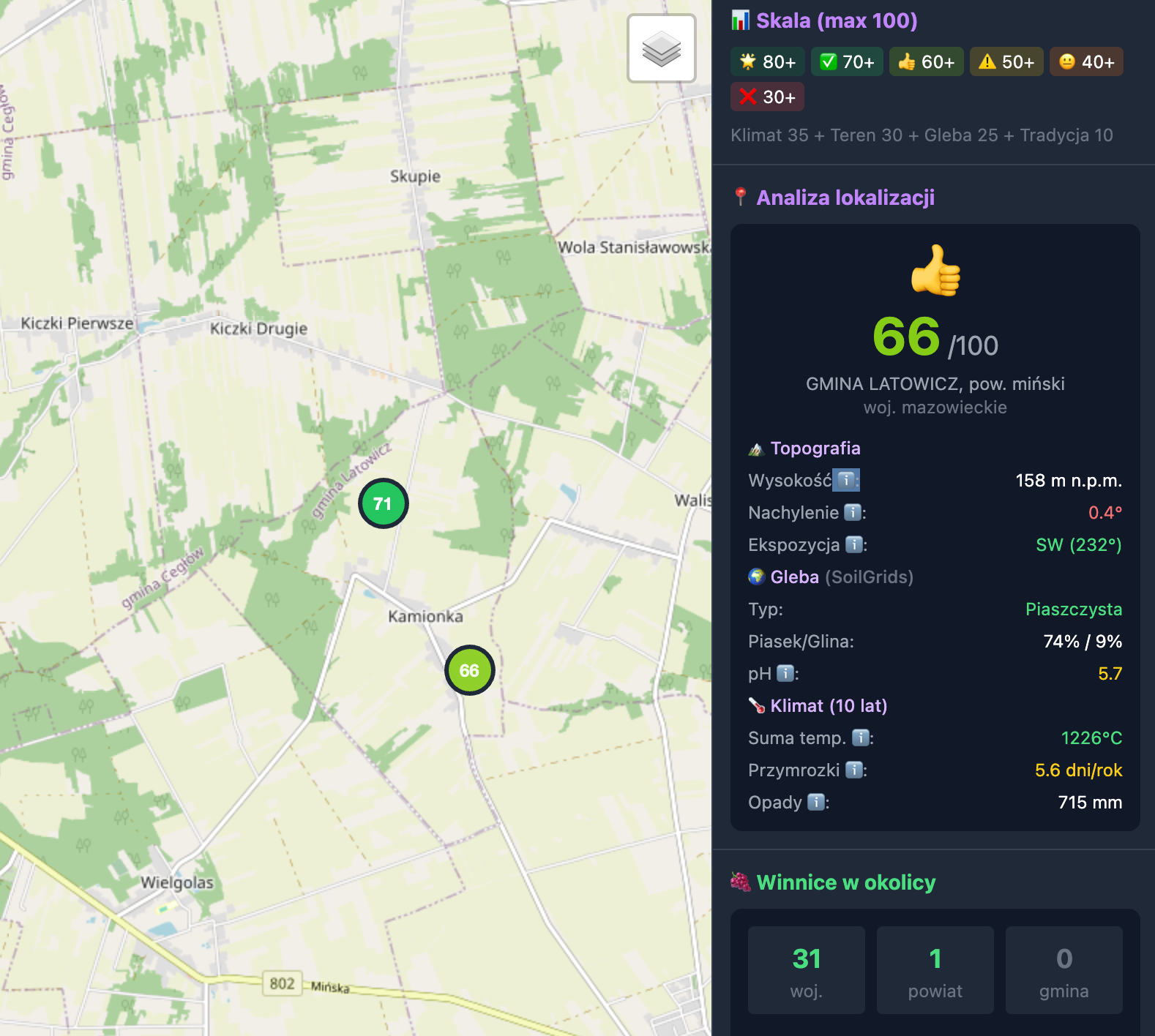
Sample report
The Scout Pro report includes detailed analysis of each point plus an interactive map you can browse online and share.
- ✓ PDF Report - all data in one document
- ✓ Interactive map - click points and compare
- ✓ Ranking - best locations at the top
- ✓ Google Maps links - go see it on site
Frequently Asked Questions
How long does it take to get the report?
You'll receive the report within 24 hours of placing your order. Usually it's ready faster - depends on the size of the area to scan.
Where does the data come from?
We use data from Open-Meteo (climate), SoilGrids/ISRIC (soil), GUGiK (elevation) and KOWR (vineyard registry). All sources are publicly available and reliable.
Can I specify a specific plot?
Yes! You can provide an address, GPS coordinates, or plot number. We scan the area around the specified point.
What if you don't find good locations?
You always get the report - even if results are poor, that's valuable information too. We'll explain why the area has low potential and where to look for better spots.
Ready to find the perfect location?
Order Scout Pro and get a professional terrain analysis.
Choose a planQuestions? Write to [email protected]